National Geographic World Atlas: Press Ready Maps And Images At The Touch Of A Button
App Type: iPhone

Our rating: 


By: National Geographic Society
Version #: 1.1
Date Released:
Developer:
Price: 1.99
User Rating:


Sure, you’ve tried using other apps designed to provide you with maps from all areas of the world, but they just didn’t cut it right? Too small, blurry, or lacking in detail because of the limitations of the size, the maps and their app were probably quickly removed from your device.
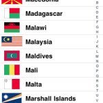
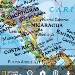
The National Geographic World Atlas app, however, will provide you with sharp images and highly usable information. With seven different levels of world-famous National Geographic cartography, and seven more layers of Microsoft Bing map coverage, those using the National Geographic World Atlas app will be pleasantly surprised at the results. Not only will someone be able to get a crystal clear image of their own street or home, but they can also request details about many countries and locations of the world too. The Flags and Facts tabs give an impressive array of socio economic facts and geographic data. Any search results can be marked, annotated and saved, and pictures can head right to the photo roll too. The app even allows on-board cameras to add photographs into the library as well. The app also interacts with the GPS to give a map of the current location.
There are many other mapping applications, but the National Geographic World Atlas app comes with the century-long cartographic expertise of the Society. It also includes an impressive six million entry database of place names and coordinates too.
The cost for the app is $1.99 and any updates come entirely free of charge. This app has been designed to function with iPhone and iPod Touch devices.
If you want workable maps that can be zoomed down to street level details, the National Geographic World Atlas app is an ideal option to download today.



 navigation