AccuTerra: Trek More Than Five Million Square Miles With Interactive Maps
App Type: iPhone

Our rating: 


By: AccuTerra by Intermap
Version #: 3.0.0
Date Released:
Developer:
Price: 0.99
User Rating:


Would you like high-resolution maps even when you are out of any WiFi area? Do you want to be able to track a trip without network connectivity too? If so, the AccuTerra app is a good choice for you. It offers avid hikers and explorers some of the most comprehensive maps, and it also allows completed tracks to be shared instantly too.
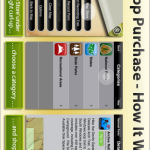
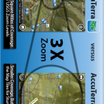
The AccuTerra functions specifically with iPhone 3G and iPhone 3GS devices and allows for easy in-app purchases of a wide array of maps. Currently more than five million square miles of United States and Hawaiian territories can be trekked using AccuTerra maps. These are remarkably high definition and interactive maps that can track the user’s progress and remain on target even when the device is no longer connected to a network – thanks to the GPS functions of the device.
The maps deliver pin-point accurate topographical data, and cover state boundaries, national parks, and major recreational areas. When a hiker has completed their journey they can send an email link through their iPhone to show friends the Google Maps version of their journey. They can also add photos to their maps as well. The same process can be done through the user’s Facebook page too.
There are all kinds of mapping, hiking, and tracks applications for mobile devices, but the AccuTerra is among the first to extend access to such a comprehensive library of maps and bundles available through in-app purchase. As stated, it functions exclusively with the iPhone 3G and iPhone 3GS devices.
The AccuTerra app costs $.99 for the download, and the map bundles will come at varying prices.
If you want a powerful and unique tool for tackling long or short hiking adventures, this is a good app to choose.


 navigation


